


The partnership aims to build the world’s most advanced digital and technology-led insurance marketplace
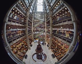
Lloyd’s of London has entered a two-year partnership with geospatial insurtech McKenzie Intelligence Services (MIS).
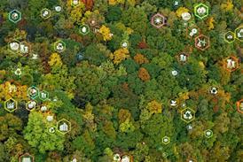
The new agreement will provide the Lloyd’s market with access to multi-source intelligence, including satellite imagery, through MIS’s Global Events Observer (GEO) platform - this aims to help market participants deliver faster claims decisions and payments for customers.
The partnership also aspires to support the Future at Lloyd’s Blueprint Two, which details plans to build the world’s most advanced digital and technology-led insurance marketplace.
Patrick Tiernan, chief of markets at Lloyd’s, said: “We are really pleased to be partnering with MIS.
“The agreement provides the Lloyd’s market with geospatial data that will enable us to better serve our customers by paying them faster and more efficiently.
“Through the Future at Lloyd’s, we have set out to create the world’s most advanced insurance marketplace and this partnership is another step towards that goal.”
‘Powered by space’
Created in 2017 and developed by MIS as part of the Future at Lloyd’s programme, GEO uses artificial intelligence (AI), machine learning (ML) and government intelligence techniques.
The platform can therefore provide the Lloyd’s market with access to real-time analysis of global perils, such as storms, wildfires and flooding.
In addition to reducing companies’ carbon footprints, the technology is expected to have a significant impact on improving the accuracy of reserving values.
GEO was co-funded and validated by The European Space Agency (ESA).
Forbes McKenzie, chief executive of MIS, said: “Our participation over the past two years in the Future at Lloyd’s programme has afforded us unparalleled insights into how our technology can add value to the whole insurance value chain.
“We would like to thank Lloyd’s for the opportunity and we are hugely grateful to ESA for co-funding and validating the GEO platform.
“We look forward to improving and refining GEO to better serve both Lloyd’s and the wider insurance marketplace.”
Volker Schumacher, business applications engineer at ESA, added: “The GEO project is a prime example of what can be achieved if globally available satellite earth observation information extraction is automised and harnessed.
“This in combination with ground-based geospatial data will help deliver an innovative, customer driven service within the Lloyd’s market.
“Through our Business Applications programme, we are supporting companies whose business is ‘powered by space’ to improve everyday activities and addressing real market needs.”


No comments yet