


The availability of more powerful computers and better data are bringing greater clarity to understanding flood risk. Some insurers, however, are being held back by legacy systems
Flood has historically been one of the most difficult natural hazards to model. But more powerful computing and improved data have combined in recent years to improve understanding of the risk.A decade ago, only large organisations like the Met Office had access to supercomputer power. Today, catastrophe modellers use thousands of computing cores and can complete multiple hazard simulation runs a day.
Flood hazard requires high performance, high-precision modelling to be of value, says JBA Risk Management technical director Iain Willis.
“You could take two houses three metres apart during a flood and find one badly damaged and the other spared.
“Historically it’s been difficult to capture that, but now, with models that go down to a five metre resolution, it’s possible.
“With the advent of greater computing power in every area of IT, risk modellers have the capacity to do more granular 2D hydraulic modelling and that’s produced very high-resolution flood maps,” he says.
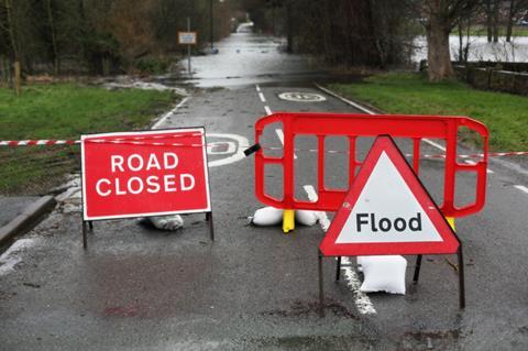
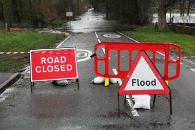
“Those maps now have the granularity to tell what the flood risk is either side of a road. That’s a huge improvement.”
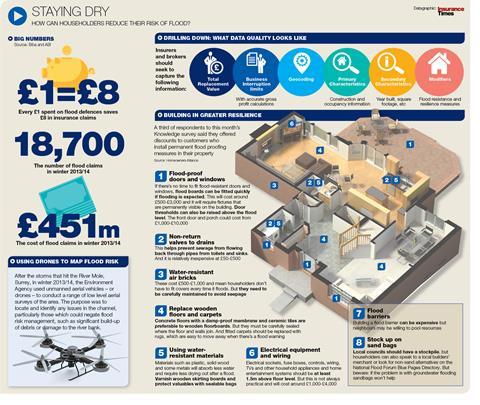
Click here for a larger version
Often, it is not until a major event occurs that more hazard data becomes available.
In Thailand, for example, models were developed after 2011’s devastating floods. Other events, including Hurricane Katrina and Superstorm Sandy in the US, have demonstrated the huge impact of storm surge.
Better with data
As a response to catastrophe events and pressure from regulatory authorities, insurers have improved their data collection and storage methods.
But 42% of respondents to a survey by Accenture last year admitted legacy systems were still holding them back.
Insurers and modellers are also increasingly looking to use new data sources, such as combining detailed digital maps with climate data to assess flood risk.
This month, flood modelling firms ESI and Ambiental announced they were joining forces to share data on groundwater flood risk.
“Groundwater flooding can significantly exacerbate surface water flood risk, and current flood mapping datasets do not consider this risk explicitly,” Ambiental managing director Justin Butler says.


No comments yet