


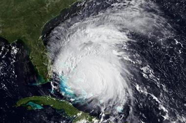
Jova to make landfall as a category 3 storm
Hurricane Jova is expected to hit Mexico as a category 3 storm tomorrow.
Jova is the ninth hurricane of the eastern Pacific storm season.
According to risk modelling firm AIR Worldwide, the storm’s maximum sustained windspeeds are 125 miles per hour with stronger gusts.
“The storm is a significant threat because it is slow-moving, and the potential exists for major flooding in Manzanillo and other locations along the coast,” said Dr. Tim Doggett, principal scientist at AIR Worldwide, in a statement. “The storm could bring 5 to 10 inches of rain over the states of Michoacan, Colima, and Jalisco with up to 15 inches possible in some locations in mountainous terrain. In addition, a slow-moving storm will also exacerbate wind damage as structures are exposed to battering winds over a prolonged period.”
AIR added that it expects damage to be significant as a result of Jova’s category 3 windspeeds.
Structural damage to houses and buildings may occur, particularly to rooftops, while windows and cladding on engineered structures could be damaged by impact from debris, the modelling firm said. Many trees will likely be uprooted and snapped, blocking roadways or damaging homes and automobiles.
AIR added that while most insured residential structures on Mexico’s west coast are made of confined masonry, which performs better than plain masonry under lateral wind loads, a large percentage of houses built every year in Mexico are constructed without a building permit, perhaps as high as 50%.


No comments yet