


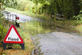


The service is already been used to provide clients with initial insured losses from the UK floods
Guy Carpenter has launched a new satellite-based catastrophe evaluation service, GC Cat-View, which aims to provide initial loss estimates of catastrophe events using satellite imagery and other data sources.
The new service has already been used by some of Guy Carpenter’s clients with exposure to the recent UK floods, with the broker providing them with initial insured loss estimates.
GC Cat-View analyses earth observation satellite and radar imagery, and combines that with footage from unmanned aerial vehicles, the media and social media, as well as ground-survey data, to produce initial loss estimates.
Using GC Cat-View, Guy Carpenter has been able to analyse detailed imagery of the areas affected by the recent UK floods to map the flood extent.
By overlaying geocoded client risk location data, the team is helping insurers identify which policies have been affected and providing associated potential loss estimates. The data will in the future also be used to prioritise and deploy loss-adjusting capabilities.
Guy Carpenter will be able to use GC Cat-View to conduct rapid loss assessments for other major natural catastrophes.
Guy Carpenter chief executive EMEA operations Nick Frankland said: “We are delighted to be able to deploy our new GC Cat-View capabilities to assist our clients in quantifying the impact of the worst flooding experienced in the UK since 2007.”


No comments yet