


Declining postcodes is too generic when insuring flood risks says LexisNexis Risk Solutions
Insurers need to take a leaf out of reinsurers’ book to use more sophisticated modelling and real-time data to proactively tackle climate change risks, says Jonathan Guard, commercial director for UK and Ireland at LexisNexis Risk Solutions.
Speaking at a Managing General Agents’ Association (MGAA) webinar yesterday, titled Extreme Weather Events: Understanding the risk to the MGA Market, Guard explained that using technology for more sophisticated modelling can help insurers be more accurate in their pricing and underwriting, as well as provide a more informed dialogue with customers to explain and mitigate potential climate change risks – this includes flooding, fire and subsidence, for example.
He said: “It’s a great opportunity for the insurance industry as a whole to be proactive and be seen taking on board the data and technology and helping customers through understanding risks from climate change.
“The role of insurance industry is to understand these events, where they’re going to happen and also [the] frequency and severity of the damage.”
Beyond postcodes
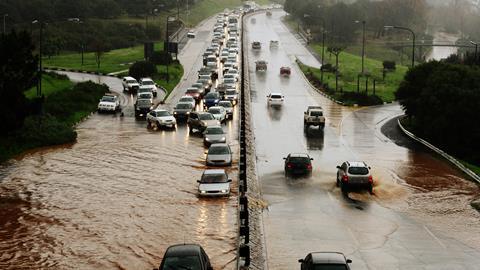
For example, Guard said that many insurers in the past used to simply decline to insure entire postcodes if they fell within a high flood risk area, yet modern technology and data can now provide a more granular and exact picture of flood zones.
Using LexisNexis Risk Solutions’s technology in a live demonstration, Guard showed how two properties within the same postcode can have very different flood risk profiles due to the elevation of the property. This type of geo-coding can, therefore, collate the perils information pertaining to a property and provide an overall score that insurers can use to help inform the underwriting process.
This is particularly useful for automated underwriting, added Guard, especially as he notes the industry shifting more towards automation in this field.
“The technology and tools bring [the data] all in together and then converts it into scores that we can use for rating and underwriting,” Guard said.
This methodology can also be used for fire risks; in particular looking at building footprints. These can show common fire risks between buildings, as well as more accurately gauge risks based on the size and shape of the property. Using these footprints also saves the cost of sending a surveyor to the site.
Guard continued: “This is really good for insurers, say working in London, where they may have capacity constraints and they’re finding it hard to manage their book of business. These tools help you to write more business because it gives a better grip and understanding of the amount of exposure that you have at a given location.
“This helps you to write more business in densely urban areas.”
Real-time data
Guard added that real-time data is also coming to the fore regarding climate change risks. For example, in the UK flood data is published every 15 minutes, while further afield mapping can be used to see storms approaching. Having this information before events hit means that insurers have the option to be proactive and prepare; this includes having more people on standby in call centres or having more staff on the ground in the vicinity.
Guard believes that this use of real-time data will be used to influence underwriting.
The next phase of mapping technology, according to Guard, is sensors installed on the outside of buildings, which can measure flood levels. This could be linked to initiatives that rebuild properties in high flood risk areas with greater flood protections, so that future flood damage will not be as severe.
Guard emphasised that climate change is not going away, so insurers need to be prepared for these specific risks.


No comments yet